Pages

Saturday, May 28, 2011

Environmental Modelling: Tools for viewing, processing large matrices

Modelación medioambiental: Herramientas para ver y procesar matrices enormes

A basic knowledge on computational programming is a very important resource for the modelling of natural systems. Following the entry on the "Water Tohoku: Tutorials" in reference to C programming and GCM data retrieving, in the current entry I cite and shortly review some tools useful for viewing and editing of large multidimensional matrices.

Why do we need to deal with large matrices?
Monday, May 23, 2011

Remote Sensing PART 5: Teaching Remote Sensing

Percepción remota Parte 5: Enseñanza de la percepción remota

5. The Remote Sensing Curriculum.

In addition to the material summarized in the previous entries, next are shown some links that show good examples on lecture contents that can be used to structure the Remote Sensing core curriculum. What I like about the material contained in the links provided is the philosophy under which the contents are developed. I hope you find it as well inspiring.

Remote Sensing PART 4: Environmental applications

Percepción remota en la práctica: Aplicaciones medioambientales

4. Remote Sensing in the practice: Environmental applications.

NOTE. Please notice that the following links provide information on some applications only. This is because my work has been principally focused on the analysis of information retrieved by optical sensors. The reason: the free access for non-commercial purposes.

There are several application intended for remotely sensed imagery. The outcomes for some fields are promising, but for others the potential has not yet been exploited principally due to the limitations in the spatio-temporal resolution at which the data is nowadays available. The limited resources at non-profit and academic institutions is also a huge limitation; nevertheless, researches have always found a way to overcome the obstacles.

Remote Sensing PART 3: Image Processing

Percepción remota Parte 3: Procesamiento de imágenes

3. Resources on Image Processing.

After having passed through the readings that explain what Remote Sensing refers to, the next concern for practical (engineering)-quantitative applications is to "use" the data contained in the imagery, i.e., to process and analyze the imagery.

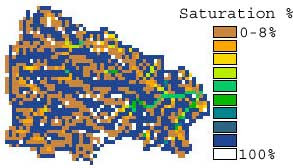
Then, after processing (e.g., using basic GIS tools), the final output may look like the product shown in the image on the left. How to do it?

Sunday, May 22, 2011

Remote sensing PART 2: Data sources, pre and post-processing tools.

Percepción remota parte 2: Datos,  herramientas de pre y post procesamiento

2. Where to get the data (global).

Next are provided links referred to Landsat, MODIS, ASTER, SRTM, TRMM data. Links to other kind of data are briefly referenced, either because the data is not public or simply because I have not used that kind of data.

2.1 NASA satellites.

Saturday, May 21, 2011

Remote Sensing PART 1: Tutorials for beginners - Intermediates

Percepción remota Parte 1: Tutoriales para principiantes - intermedios

Remote Sensing is perhaps the field for which I have found the largest volume of resources throughout the WEB. Personally, I think that for practical and engineering applications the amount of free information available may fulfill the expectations at an introductory stage.

1. Remote Sensing Tutorials for practical quantitative applications.

Wednesday, May 18, 2011

Imaginative technology for disaster stricken zones

Tecnología imaginativa para zonas golpeadas por desastres

Today, BBC news has posted an interesting article where are reviewed some "gadgets for disaster zones". The article is written by Jack Lamport, and presents three options to cope with major issues faced during a natural or "man made" (as if we did not have enough with the nature) disasters.

1. SHELTER: Concrete canvas

Monday, May 9, 2011

Video lectures

Video-lecciones

videolectures.net is a repository of video lectures given by recognized scientists from around the world. It is aimed at promoting knowledge sharing within the scientific community and towards the general public. Opposed to the general miss belief in developing economies that knowledge and information means power (money), the trend of sharing information seems to grow (fortunately!!!).

Few years ago (notice that I am not talking about decades), the access to free resources and information over the internet was not as abundant as it is today. As I remember, an inflection point was established by Wikipedia in the early 2000´s and of course Youtube, back in 2006. Those initiatives established the basis for the social networks, which currently are the most common ways to share information, thoughts, and opinions. The scientific community has joined that tendency, perhaps after having realized that science is concerned to the action of every single individual.

The Opencourse Ware initiative

Friday, May 6, 2011

VIdeo: Recording, playing and editing.

Grabación, edición y apertura de videos

Multimedia is quite fun and it is also useful for educational purposes. Here are some links to resources I found useful to play with:

Monday, May 2, 2011

Climate change: Ecopolis

Cambio climático: Ecopolis

"Ecopolis" is the title of a TV programme broadcasted in the Discovery Channel that I was watching this morning. The programme presented the perspective of the professor Daniel Kammen (University of California, Berkeley) on which would be the top 4 most demanding alternatives to face climate change issues related to energy production in mega cities.

Related Posts Plugin for WordPress, Blogger...